
Summer Trail 15 - Col de la Vallée Etroite from Plan d'Eau des Bruyères
Description
Hike above Lac du Lou passing through the Pierre Blanche lakes. A stunning Alpine walk with many beautiful flowers nestled between the rocks and outstanding views of Mont Blanc and the Ecrins from the top.
The start is the same as for Route 12. Refer to that route and follow steps 1 through 4. You can also start from Val Thorens (see Route 40). Pass the mountain hut and ignore a trail on the right. At the next fork, take the trail on the left that runs along and overlooks the lake.
After passing the end of the lake, go around a bog before crossing the Lou torrent on a narrow footbridge. Continue on the rocky trail. The Revers torrent bubbles to the left. Downstream from the Lachemonde chalet, leave the bank of the
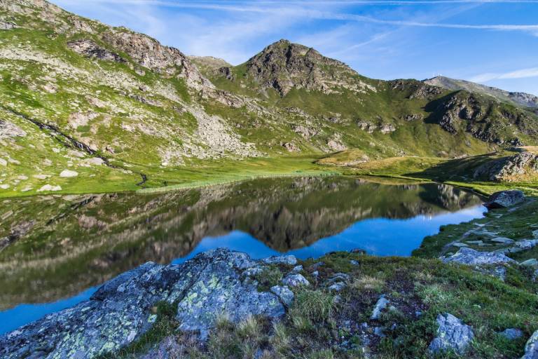
torrent, climb to the right, and go around the building on the left. The trail now climbs along rocky outcrops and overlooks the Revers valley. The slope levels off alongside a stream that you cross over stones, then a steep section leads to the first Pierre Blanche lake. Cross the spillway by stepping over the rocks. This lovely high-altitude lake with crystal-clear water is surrounded by peat bogs that are home to many protected species.
The trail runs along the left side of the lake, then climbs and turns left. You enter a tiny valley at the end of which you come face to face with a large sloping rock slab. Go around it on the right, leaving the trail leading to the Col de Pierre Blanche on your right, and veer left along the rocks. You’ll reach a flat area where the two small upper lakes of Pierre Blanche are located.
Above the lakes, the trail skirts a rocky area to the left, then levels off and heads to the right. You cross a first small pass, then a second (2,495 m), before descending slightly. You will then be walking with Mont Brequin (3,130 m) directly ahead of you—
guided ascent—information available from the Guides’ Office. The trail then climbs toward the pass through a grassy area, after which the slope steepens, and you reach the Col de la Vallée Etroite via a final ascent over a scree slope.
Return via the same route. The landscape, however, is completely different: we walk with Mont Blanc ahead of us, and the lakes—which didn’t come into view until so late on the way up—can be admired at leisure on the way down.
Steep sections before the Pierre Blanche Lakes
Marking
This trail is marked with yellow signs.